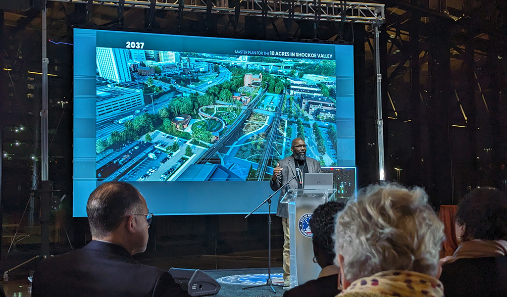
Situated in the heart of Richmond, Virginia, lies Shockoe Bottom—the city’s oldest neighborhood that played a major role in American slavery between the late 17th century and 1865. Since then, the neighborhood’s past has slowly been erased with the addition of major municipal infrastructure projects, Interstate-95, rail, and urban renewal. Despite these obstacles, the City of Richmond is striving to uncover, acknowledge, and pay tribute to Shockoe’s profound and difficult history where more than a quarter of a million people were sold into slavery.
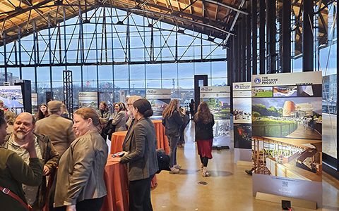
Known as The Shockoe Project, the city and key stakeholders developed a comprehensive plan for 10-acres of city-owned property to memorialize this history. The plan was revealed to the public on February 27, and schematic design is underway. The comprehensive plan includes a new National Slavery Museum, serving as the anchor point for the site, an event lawn, gardens, a restaurant pavilion, visitor parking, and a 1,200-foot pedestrian bridge. These new spaces will also intricately connect the nationally-recognized Lumpkin’s Slave Jail Site, the African Burial Ground, and a 2.5-mile path known as The Trail of the Enslaved.
In collaboration with Baskervill Architects and Waterstreet Studios, VHB is contributing to The Shockoe Project’s master plan. Providing civil engineering and technology services, VHB will oversee grading and drainage development in the schematic design phase after providing a hydrology and hydraulics study of the floodplain for the master plan.
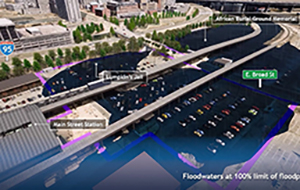
“One obstacle this project faces is that most of the project site lies within the 100-year floodplain,” said Charlene Harper, VHB Project Manager. “As extreme weather conditions increase, we must prepare for a possible significant flood event and safeguard the stories, struggles, and triumphs of the enslaved people who came before us. It is our duty through thoughtful design to preserve this site for future generations to learn and understand their history.”
Through digital project delivery, VHB used digital twin technologies to compare the current site conditions with 1877 maps, enabling comprehensive analysis of environmental changes over time. Digital twins provided a virtual representation of the physical environments, allowing VHB design teams to simulate various project scenarios with stakeholders to enhance decision-making. See how the flood plain impacts the site.
Stay up to date with The Shockoe Project, and connect with Charlene Harper via email or LinkedIn.