VHB is continuing its partnership with the cities of Boston and Revere to advance the Resilient Bennington Street and Fredericks Park project—an important regional initiative designed to strengthen coastal resilience while enhancing transportation and ecological resources along the Belle Isle Marsh corridor.
The project is identified as a key element of the City of Boston’s Climate Ready Boston initiative, which identifies neighborhood-scale strategies to address coastal flooding and sea level rise. As part of this effort, VHB has been working with both municipalities to develop infrastructure solutions along Bennington Street in East Boston and Fredericks Park in Revere that help protect nearby neighborhoods and critical infrastructure from future flood events. The project site is critical in that it is adjacent to Belle Isle Marsh—the largest remaining salt marsh in Boston Harbor—and Bennington Street serves as one of two designated evacuation routes for East Boston and the Town of Winthrop.
Over the past several years, VHB has supported the project through early planning and feasibility analysis funded through a Municipal Vulnerability Preparedness (MVP) Grant from the Commonwealth of Massachusetts. During this phase, the team conducted site surveys, environmental assessments, and geotechnical investigations, while evaluating strategies to address coastal flooding risks and navigate the complex local, state and federal permitting processes.
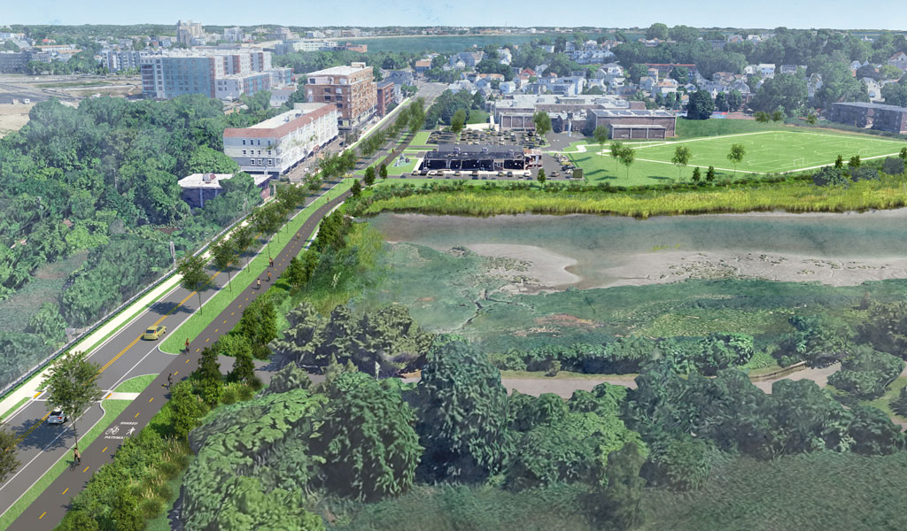
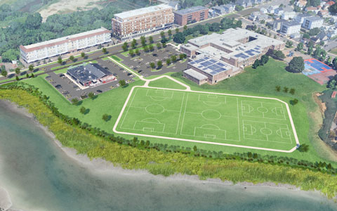
The recommended approach integrates several resilience strategies designed to work together across the corridor. Proposed elements include raising sections of Bennington Street, creating a nature-based “living levee” and improved recreational space within Fredericks Park, and incorporating targeted flood protection measures such as levees or seawalls where appropriate. Ultimately, implementation of these strategies will help reduce flood risk to thousands of homes, as well as the MBTA Blue Line tracks and Beachmont Station, while enhancing the surrounding public realm.
In addition to flood protection, the project also supports improvements to the corridor’s transportation and environmental conditions. Planned upgrades include the addition of a shared-use path to support multimodal travel and the reconfiguration of paved areas to create opportunities for ecological restoration adjacent to the Belle Isle Marsh. Allowing portions of the marsh to migrate inland over time will strengthen the long-term resilience of this coastal ecosystem.
VHB recently completed the schematic design phase of the project, marking an important milestone in advancing the preferred resilience strategies for the corridor. The schematic design builds on earlier feasibility work and provides a more detailed framework for how coastal protection, roadway improvements, and park enhancements can work together to support long-term climate resilience.
As the project progresses, VHB will continue working with municipal partners and stakeholders to refine the design and prepare for the next phases of implementation.
Learn more about VHB’s climate resilience and coastal infrastructure work.