Collecting traffic data is critical to understanding the impact of an infrastructure project on the surrounding environment. Intersect revolutionizes the way we identify volumes and view traffic movements on a transportation network, leveraging big data to provide accurate, trusted results whether a project is in a rural, suburban, or urban area.
Intersect combines probe data from multiple sources—like cellular, location-based sensors, or connected vehicles—to present a comprehensive view of the transportation network. Intersect optimizes this data to deliver traffic counts, turning movements, and origin destination information, while uniquely using existing count data as controls to further enhance accuracy and incorporate investments that agencies have already implemented in the field.
![]()
We use an innovative process to deliver detailed 24/7 traffic volumes, travel times, roadway speeds, and congestion hot spots, avoiding the need to conduct these studies in the field and making it ideal for corridor analysis.
-
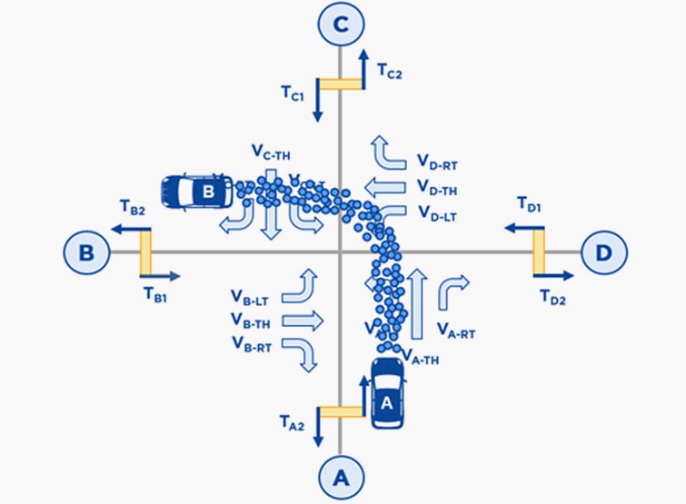
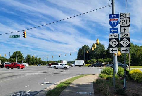
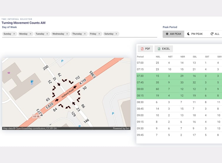
Turning Movement Counts (TMC)
As a transportation planning tool, Intersect uses big data to review probe information obtained from cell phones and connected vehicle technology to develop intersection traffic volumes and turning movement counts without the need of traditional field deployed devices. Using individual trip path information allows Intersect to successfully account for vehicular volumes at urban, suburban, or rural intersections, along with the ability to provide year-round availability.
-
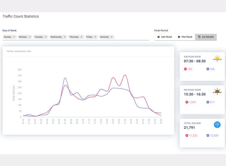
Roadway Volumes
Intersect provides what a typical Automatic Traffic Recorder (ATR) or camera or manual counts would calculate but expands to include and determine Average Daily Traffic (ADT), or Annual Average Daily Traffic (AADT), and identify hourly trends and peak periods of travel. The use of control points from deployed devices and detection systems further enhances Intersect abilities to leverage investments made by agencies while providing coverage on all roadway types in a network regardless of classification.
-
Origin & Destination
Intersect has the ability to provide Origin and Destination (OD) information across the transportation network, including how travelers are moving on the network, the roadway paths that are taken, and how conditions on the network impact traveler decisions.
-
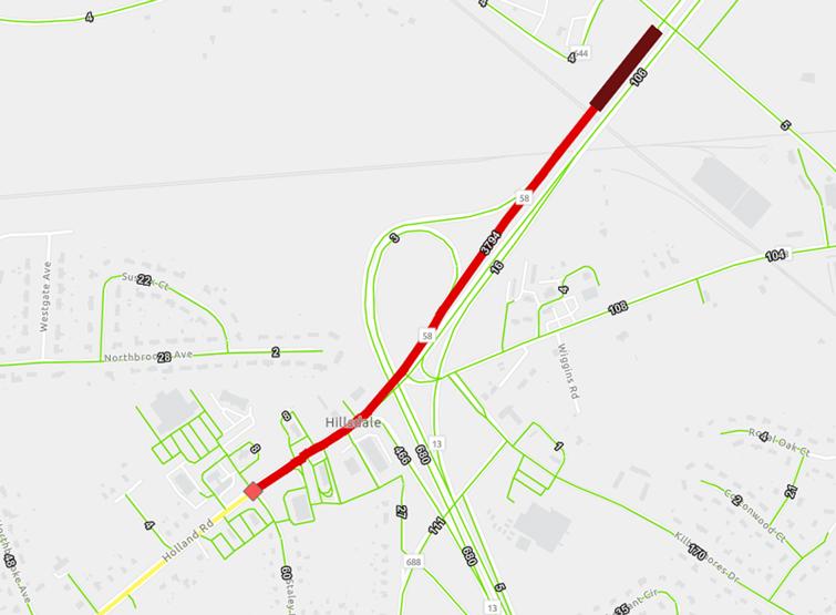
Corridor Analysis
Intersect provides users the ability to use probe data to deliver detailed 24/7 travel times, roadway speeds, and congestion hotspots, avoiding the need to conduct these studies in the field.