Forward-thinking insights focused on a more sustainable tomorrow.

Seeing the Unseen: Leveraging Reality Capture to Transform Design, Safety, and Decision-Making
April 2026
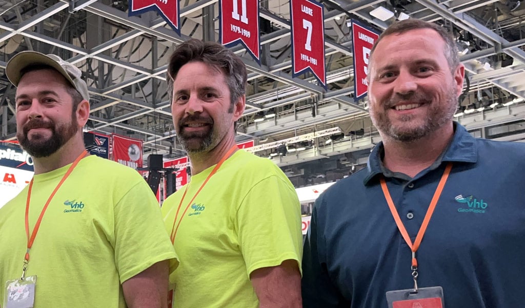
At VHB, everything we design, study, and plan relies on precise data. Geomatics, the science of capturing, analyzing, and managing spatial data, provides the accuracy and reliability that make this work possible, and Shaun Lewis plays a key role in upholding these standards for our team.
In recent years, Shaun has been deeply involved in applying reality capture technology on complex projects where accuracy, access, and coordination are critical. By using advanced geomatics tools to document existing conditions and validate digital models, he helps teams replace assumptions with reliable data, setting the stage for smarter design, fewer surprises, and better outcomes.
As a leader on VHB’s geomatics team, Shaun is at the forefront of an industry revolution where the future is built on technology, technology is built on data, and data is built on geomatics. His dedication to innovation translates into smarter solutions for clients, and a strong, more efficient team. This is Shaun’s story.
Turning Real Places into Digital Insight
Every project begins with a real environment, whether it’s a bridge, trail, or facility that has evolved over time. Before designing what comes next, we need to understand what’s already there. That’s where reality capture makes a difference.
Using tools like terrestrial laser scanning, mobile LiDAR, and aerial platforms, we collect millions of data points to create a precise, three-dimensional record. But to me, it’s more than just data. It’s clarity.
I’ve seen this approach transform complex facilities, historic structures, and sensitive natural or subsurface environments. Instead of relying on outdated drawings or repeated site visits, we capture conditions once, accurately, and revisit them virtually. Everyone works from the same source of truth.
Step inside Mammoth Cave from anywhere: this reality capture video lets you navigate the tunnels and trails as if you were there / 0:32
When Traditional Documentation Isn’t Enough
Many environments I work in have constraints: tight clearances, irregular geometry, active operations, or limited access. While traditional survey remains a core part of our work, reality capture complements it by providing a comprehensive dataset in a single visit. This is especially valuable in active transportation environments where conditions are constantly changing and teams need accurate information without disrupting traffic flow.
A great example of this happened recently in Floyd, Virginia, where our Reality Capture Geomatics team supported VDOT and the Virginia Tech Transportation Institute during a signalized intersection evaluation. VDOT requested our assistance to hover a drone over the intersection and capture continuous video of traffic queuing to support performance analysis. To make that happen, our team maintained a nearly continuous aerial video feed for hours, completing fast battery and memory card swaps to minimize downtime. The result was a detailed dataset collected safely and efficiently, giving VDOT the information they needed to evaluate operations and performance without interfering with live traffic.
Using drone-based reality capture, our team recorded near-continuous aerial video of traffic queuing to support VDOT’s signalized intersection performance evaluation / 0:15
From Data to Confidence
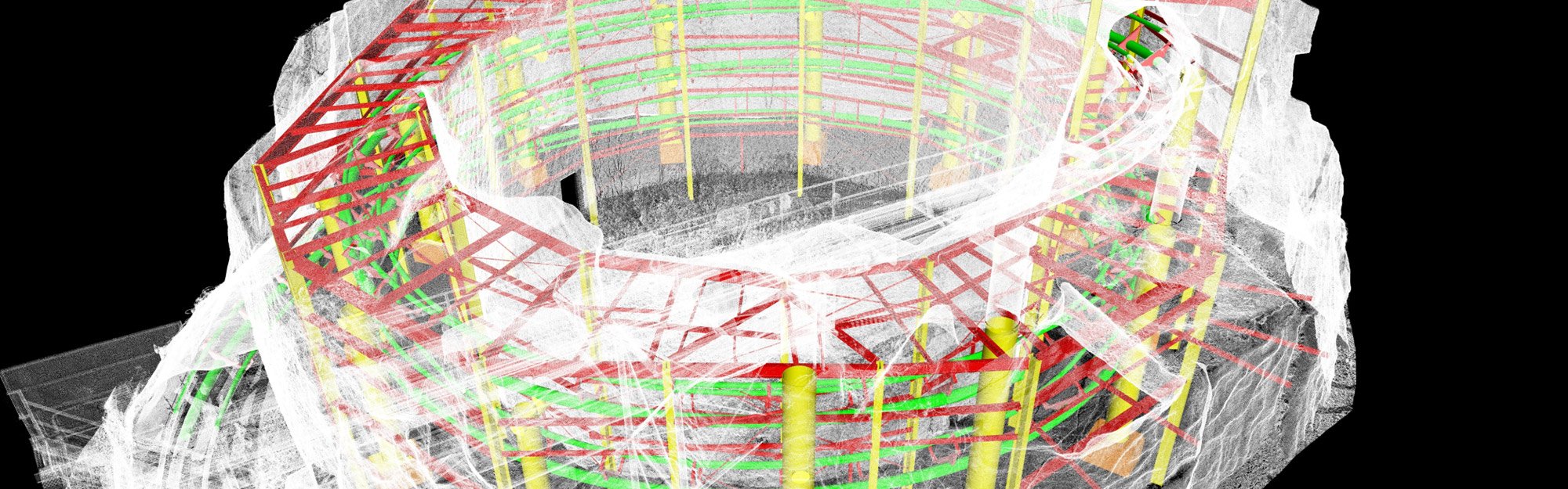
A point cloud is a detailed digital snapshot of existing conditions, composed of millions of precise data points that drive informed decision-making. From a single point cloud dataset, teams can create digital twins, as-built drawings, and 3D models that support design and construction from day one.
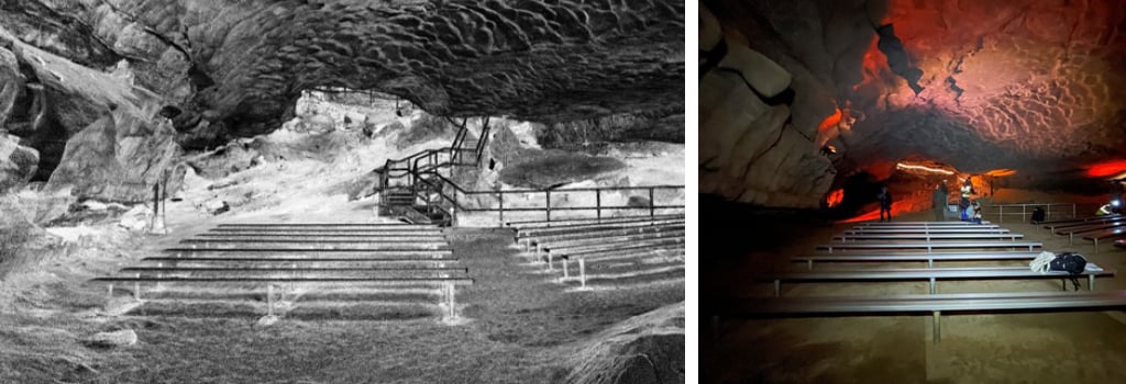
This impact is even more critical in historic and physically constrained environments. At Mammoth Cave National Park, reality capture helped document tunnel-like subsurface spaces and historic trail systems where access is limited and resources are sensitive. Capturing the full spatial complexity once, and returning to it virtually, reduces field exposure, minimizes impact, and gives designers an in-depth understanding that traditional methods alone can’t easily achieve.
Verifying conditions early leads to fewer surprises, smoother transitions into construction, and confidence that designs reflect reality.
A Site Everyone Can See
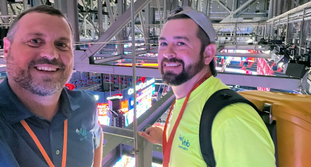
Collaboration is one of the biggest shifts I’ve seen. On renovation projects like the Capital One Arena renovation, reality capture created a shared virtual environment of operational spaces that are otherwise difficult to fully understand.
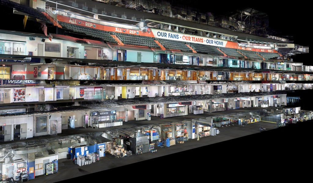
Cloud-based walkthroughs let designers, stakeholders, and contractors explore the site remotely, verify conditions, and plan work with confidence. When everyone works from the same accurate model, conversations are clearer, assumptions fade, and decisions move faster.
Why It Matters
Technology will continue to evolve, but tools alone aren’t enough. What matters is knowing how to collect the right data and make it useful.
For me, reality capture isn’t just documenting space, it’s reducing uncertainty and giving teams confidence to move forward safely, efficiently, and with fewer unknowns.
That’s why I believe it’s changing the way we design. At VHB, we’re proud to bring these tools and techniques to our clients. By embracing advanced technology, we’re not just documenting spaces — we’re empowering teams to design, plan, and build with greater certainty.
Learn more about Geomatics at VHB or reach out to me for more information by emailing me or connecting on LinkedIn.