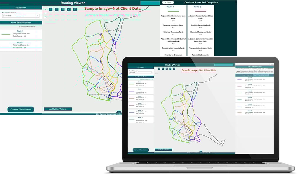
VHB developed a transmission line route analysis model in ArcGIS Pro to provide a more dynamic, efficient, and scalable scoring system that can easily assess potential routes. Prior to this, routes were typically scored by manually inputting data into several interlinked spreadsheets. This transformative model offers an innovative alternative that translates data into code and delivers an interactive GIS visualization of potential routes.
Benefits of this model include easy visualization of route scoring factors, such as open space, wetlands and waterways, residential and commercial land uses, sensitive receptors, historical resources, transportation impacts, existing utility density, and potential to encounter subsurface contamination.
The client developed a scoring matrix to weigh how the route will affect the community. Users can update weights for each category to prioritize different elements when evaluating a route and see how these changes will affect the score. The model then ranks each category and allows users to see which is affecting the score the most. By numerically quantifying categories, the impacts of a given element across multiple routes can easily be compared.