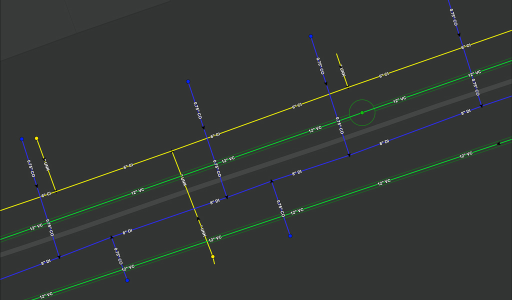
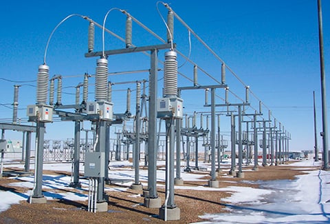
To help Eversource understand the layout of subsurface utility structures, conduits, and pipes, VHB is mapping all existing underground utilities for a 42-mile-long project in the greater Boston area. Our Geomatics team is delivering surveyed ground control, on-the-ground utility survey, and detailed, multi-faceted subsurface utility engineering (SUE) services to create an innovative map deliverable that will provide Eversource with a clear picture of the current configuration of underground utilities.
VHB is leveraging our Geomatics Data Management (GDM) system and enterprise GIS platform to integrate Esri web applications such as dashboards, experience builder apps, Web Editor, and Survey123 applications, in conjunction with Trimble SiteVision. Our automated process for manhole field inspections uses specific survey point locations based on feature code to populate a VHB-developed Survey123 smart form application that enables efficient and accurate data collection of the manhole’s characteristics and measurements, along with pictures and sketches by field personnel through Esri Field Maps.
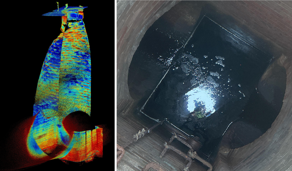
VHB also developed an innovative approach to manhole inspections by using Trimble SiteVision to complete a Light Detection and Ranging (LiDAR) scan of gravity structures. This method captures a 3D point cloud to extract invert depths, pipe sizes, pipe material, subsurface structure size, and condition. The extracted information is entered into a utility dataset via the Survey123 form and processed through a custom-built geoprocessing tool to generate the system visualization and the CAD deliverable in 3D features. The 3D point cloud can be accessed remotely at any time, thereby reducing the need for costly repeat visits to the same structure.