
Government agencies depend on accurate geographic information to support planning, operations, public services, and community investment. VHB helps state, county, and local governments transform complex data into practical mapping tools that improve access to information, support informed decision-making, and create better outcomes for the communities they serve.
Counties and municipalities often work with fragmented records, outdated maps, and legacy systems that make geographic information difficult to maintain and use. For more than two decades, VHB has partnered with New York State agencies and local governments to modernize this information and build GIS solutions around the way their teams work.

“VHB is one of twelve companies worldwide to earn Esri’s Parcel Management Specialty designation, as a testament to our experience implementing Esri’s ArcGIS Parcel Fabric and Land Records solutions. We partner with clients to take advantage of GIS enabled, record driven workflows to manage, edit, track, and share parcel information efficiently and accurately. Technology-enabled consulting is at the core of what we do, and this recognition underscores our commitment to integrating advanced tools that support assessing, planning, engineering, and design needs across New York.”
—Christine Smith, Northeast Regional GIS Leader
VHB works at the intersection of GIS, assessment, planning, and infrastructure to help clients to turn complex records into reliable, accessible data. Our teams transform paper-based tax maps, Mylar maps, CAD drawings, legacy ArcInfo files, and other source materials into accurate, consistent digital parcel databases that integrate with existing systems and support everyday needs—from locating parcels and validating ownership to analyzing land use and communicating information to staff, boards, and the public.
We support the ongoing use and maintenance of that data through ArcGIS training for tax map technicians, practical parcel maintenance manuals, and internal and public-facing parcel viewers that make property information easier to find and understand.
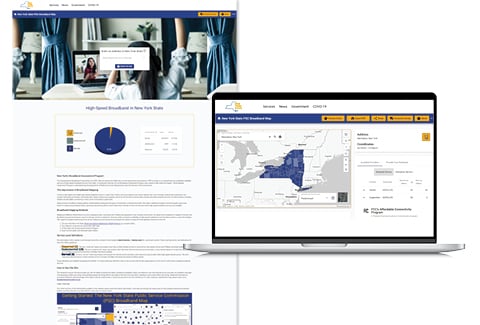
VHB helps agencies integrate GIS with zoning, infrastructure, environmental, and assessment information and develop web-based maps, applications, and dashboards for staff, decision-makers, and the public. Across New York, these solutions support more than 20 local governments, helping them make better use of GIS in day-to-day operations and long-term planning.
How VHB Can Help
VHB’s GIS practice extends beyond parcel management to the broader systems that agencies rely on every day. Our specialists design, implement, and optimize enterprise GIS platforms that connect parcel data with zoning, infrastructure, environmental, and assessment layers in a single, integrated environment. We partner with clients to modernize data governance, configure ArcGIS Online and Portal, and develop mapping applications and dashboards that turn complex geospatial information into clear, actionable insight for staff, leadership, and the public.