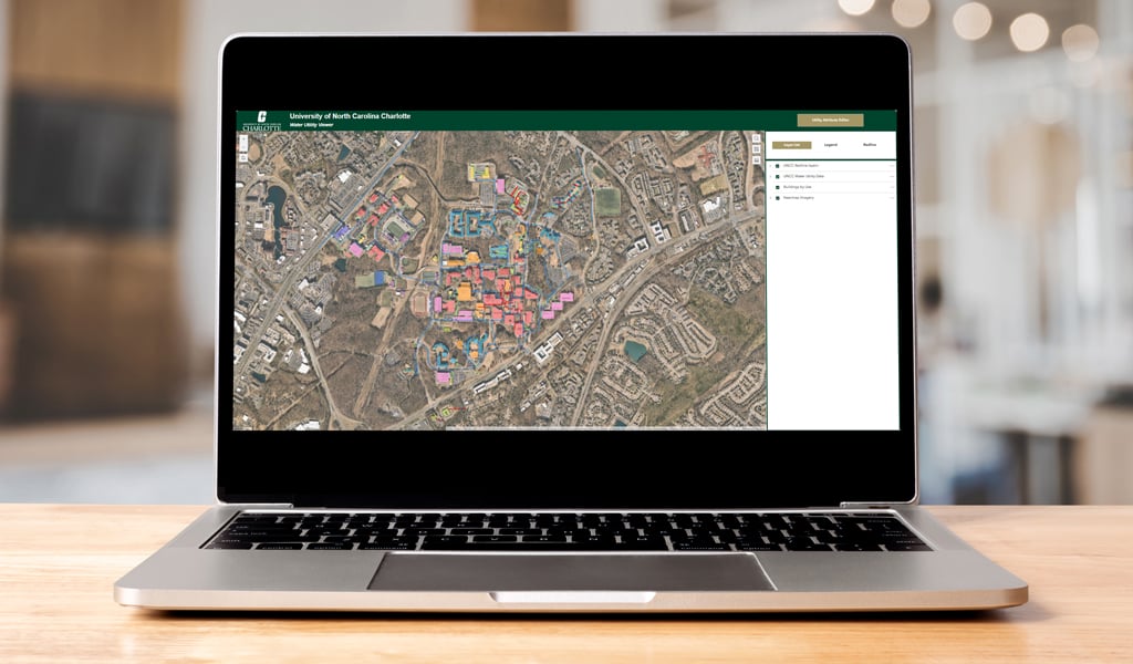
The UNC Charlotte Campus Water Distribution Modeling project, a collaboration between VHB and UNC Charlotte Facilities Management, turned outdated records and knowledge of the campus water system into a dynamic asset management tool using Esri and WaterGEMS modeling software. Over the span of nine months, VHB successfully implemented Esri’s Utility Network, by using modern data mapping and validation techniques to convert UNC Charlotte’s existing GIS files, subsurface utility engineering (SUE) plans and as-built drawings to create a reliable digital twin of the campus’ water distribution network.
VHB played a pivotal role by guiding and architecting workflow solutions for the development of the water distribution Utility Network data model, essential for promoting data compatibility with modern systems. This process involved converting various data formats and making attribute changes to existing GIS information. New workflows were implemented to integrate these resources seamlessly into the WaterGEMS hydraulic modeling framework, enhancing operational efficiency.
GIS support services included creating interactive data viewers using Esri’s ArcGIS Experience Builder, facilitating exploration, and rigorous quality assurance processes. Through innovative integration and modeling strategies, VHB developed a comprehensive framework to build an informative digital twin that accurately mirrors the campus water network. With this living, interactive model, UNC Charlotte will be able to quickly identify issues, plan future system upgrades, and make data-driven decisions aimed at saving time, reducing costs, and preventing service disruptions.