VHB was retained by the City of Boston to design and build an inventory of the shadow conduit and dark fiber resources at the City’s disposal. The VHB team compiled 20 years’ worth of information and delivered a comprehensive inventory of the City’s network, including the Boston Transportation Department assets that exist in the City, as well as a custom-built GIS web application that was readily available for City staff needs. This was achieved through a multi-step process that included:
- Workshop Facilitation with City staff to define initial and long-term characteristics of the network that needed to be captured.
- Data Model Construction: A flexible data model was created using Esri’s telecom data to extract critical components and create a simplified fiber model which could then be used as a starting point for future models.
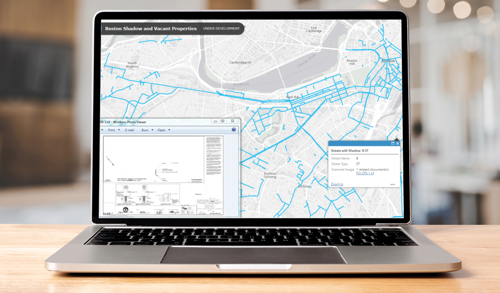
- Source Materials Collection and Fiber Network Inventory Creation: Over 1,000 mylar plans depicting the ownership and availability of dark and lit fibers within the City were scanned and attached to the associated street segments using Esri’s ArcGIS for Desktop. Working from these source documents, the VHB team then created a comprehensive digital inventory of the fiber network.
- Data Retrieval Viewer Development: VHB created an Esri’s ArcGIS Online Interactive web application for City use, customized so that users can search data by addresses, project numbers, or project names. The map illustrates where fiber does and does not exist within the City and will be used to plan the expansion of the fiber network on a citywide basis.