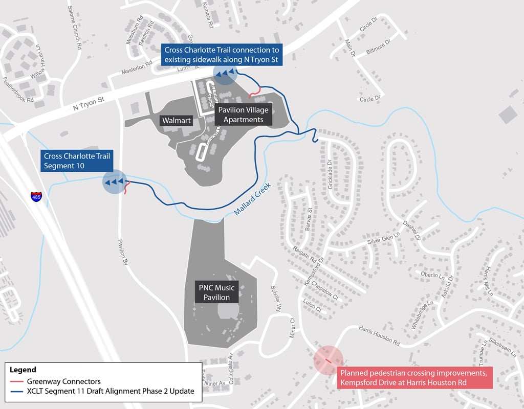
The City of Charlotte Community Investment Plan (CIP) is a program developed to meet the growing needs of its citizens. The CIP focuses on increasing access and availability of transportation choices for residents by means of investing in streets, transit, and bicycle and pedestrian facilities. The Cross Charlotte Trail (XCLT) is one of the premier projects within the CIP program and is a partnership between the City of Charlotte and Mecklenburg County to create a continuous, approximately 30-mile greenway facility that will extend from the City of Pineville through Center City and on to the Cabarrus County line. The trail is intended to bring citizens together to enhance mobility and access to public spaces while creating a vibrant, healthy, and equitable community. Transit users will also be able to use the XCLT as a first-mile, last-mile connection to existing and planned CATS bus and light rail corridors.
VHB’s transportation team provided a planning study and 30 percent design services for Segment 11 of XCLT, the northern-most section of the trail. The study included the evaluation of existing conditions, surrounding developments, topography, environmental constraints, and existing easements. The study identified several alignment alternatives, including bridge options over Mallard Creek with associated benefits and drawbacks for each trail route option under consideration. A preliminary evaluation was also performed within the overall project study area to identify wetlands, ponds, and streams. Preliminary designs were prepared for the preferred alternative. Cost estimates were developed based on 30 percent designs and broken up into shorter sections to allow for phased implementation of the project by the City and Mecklenburg County.